


Smith Voting District, Hampton city, Virginia
About
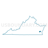
Outline

Summary
| Unique Area Identifier | 682905 |
| Name | Smith Voting District |
| County | Hampton city |
| State | Virginia |
| Area (square miles) | 1.40 |
| Land Area (square miles) | 1.37 |
| Water Area (square miles) | 0.03 |
| % of Land Area | 97.87 |
| % of Water Area | 2.13 |
| Latitude of the Internal Point | 37.03730210 |
| Longtitude of the Internal Point | -76.31927350 |
Maps


Graphs
Select a template below for downloading or customizing gragh for Smith Voting District, Hampton city, Virginia


Neighbors
Neighoring Voting District (by Name) Neighboring Voting District on the Map
- Bryan Voting District, Hampton city, VA
- East Hampton Voting District, Hampton city, VA
- Jones Voting District, Hampton city, VA
- Kecoughtan Voting District, Hampton city, VA
- Phoebus Voting District, Hampton city, VA
- Syms Voting District, Hampton city, VA
- Thomas Voting District, Hampton city, VA
Top 10 Neighboring County Subdivision (by Population) Neighboring County Subdivision on the Map
Top 10 Neighboring Place (by Population) Neighboring Place on the Map
Top 10 Neighboring Unified School District (by Population) Neighboring Unified School District on the Map
Top 10 Neighboring State Legislative District Lower Chamber (by Population) Neighboring State Legislative District Lower Chamber on the Map
Top 10 Neighboring State Legislative District Upper Chamber (by Population) Neighboring State Legislative District Upper Chamber on the Map
Top 10 Neighboring 111th Congressional District (by Population) Neighboring 111th Congressional District on the Map
Top 10 Neighboring Census Tract (by Population) Neighboring Census Tract on the Map
- Census Tract 101.04, Hampton city, VA (6,536)
- Census Tract 110, Hampton city, VA (6,109)
- Census Tract 108, Hampton city, VA (5,317)
- Census Tract 112, Hampton city, VA (2,839)
- Census Tract 114, Hampton city, VA (2,784)
- Census Tract 113, Hampton city, VA (2,207)
- Census Tract 109, Hampton city, VA (2,092)